
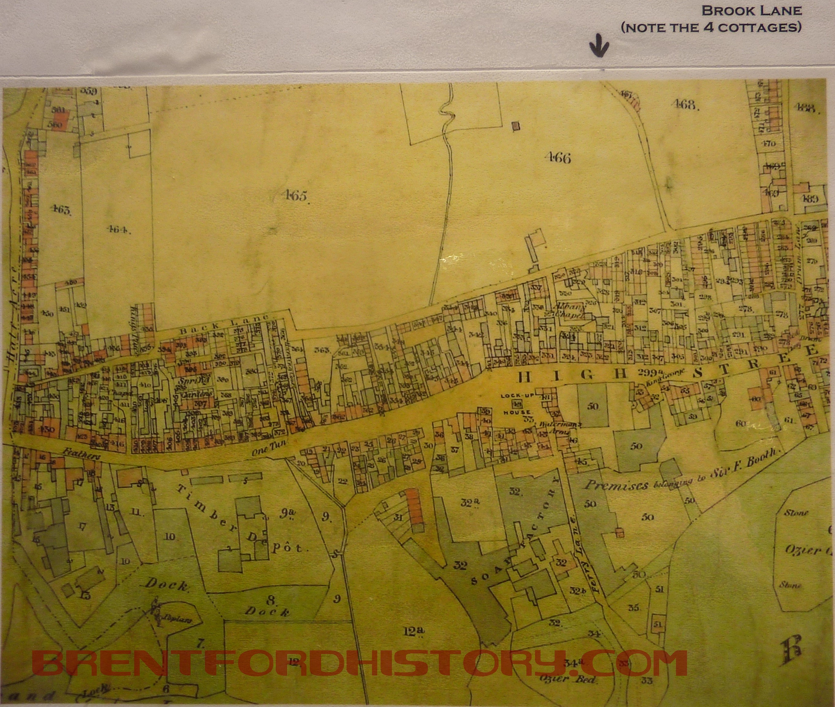
The Tithe Map of Brentford in 1841 shows that the area of the town west of Drum Lane (now Ealing Road) was tightly packed buildings between the High Street and Albany Road with open ground beyond. Running north to south is a blue line marking the route of the brook. Parallel with the water course is a narrow road and at a sharp bend there are four cottages later called Brook Terrace.
On old maps the route of this waterway can be followed to the high ground north of Ealing Broadway running between Northfields Avenue and Ealing Road. It may have been incorporated into the lake at Walpole Park and be the reason that Culmington Road was once known as Frog Lane. There’s still an open ditch running north from Little Ealing Lane and it must have been the waters from that that were blocked to form the fish ponds at the house known as Ealing Park.
Radbourne Avenue was built on that site.

The route of The Brook can still be followed running downhill and south along Junction Road as it cuts across the residential roads running between Ealing and Windmill Roads. At Whitestile Road there was still an open stream shown on the 1894 OS map. This is marks the junction between the Victorian houses and those built to the east in the 1920s as ‘homes fit for heroes’ after the First World War.
The watercourse ran along the bottom of the gardens on the south side of Enfield Road, probably along the southern end of the footpath between there and Eastbourne Road, across that road and would follow the route where the pedestrian lights cross the Great West Road and into Brook Lane. The railway was built over the waterway in the 1840s and may even have used the water for the steam engines in use at the time. By the 1870s the 12, Phoenix Cottages south of the footbridge shared a pump that presumably also took water from the Brook.
In the 1920s a long time resident remembers the open water and a field behind his house opposite the football ground. Cows grazing where the girl’s school now stands went to drink from the brook. It seems that the way Brook Road South was built was partly governed by the water course and the brook followed the lie of the land.
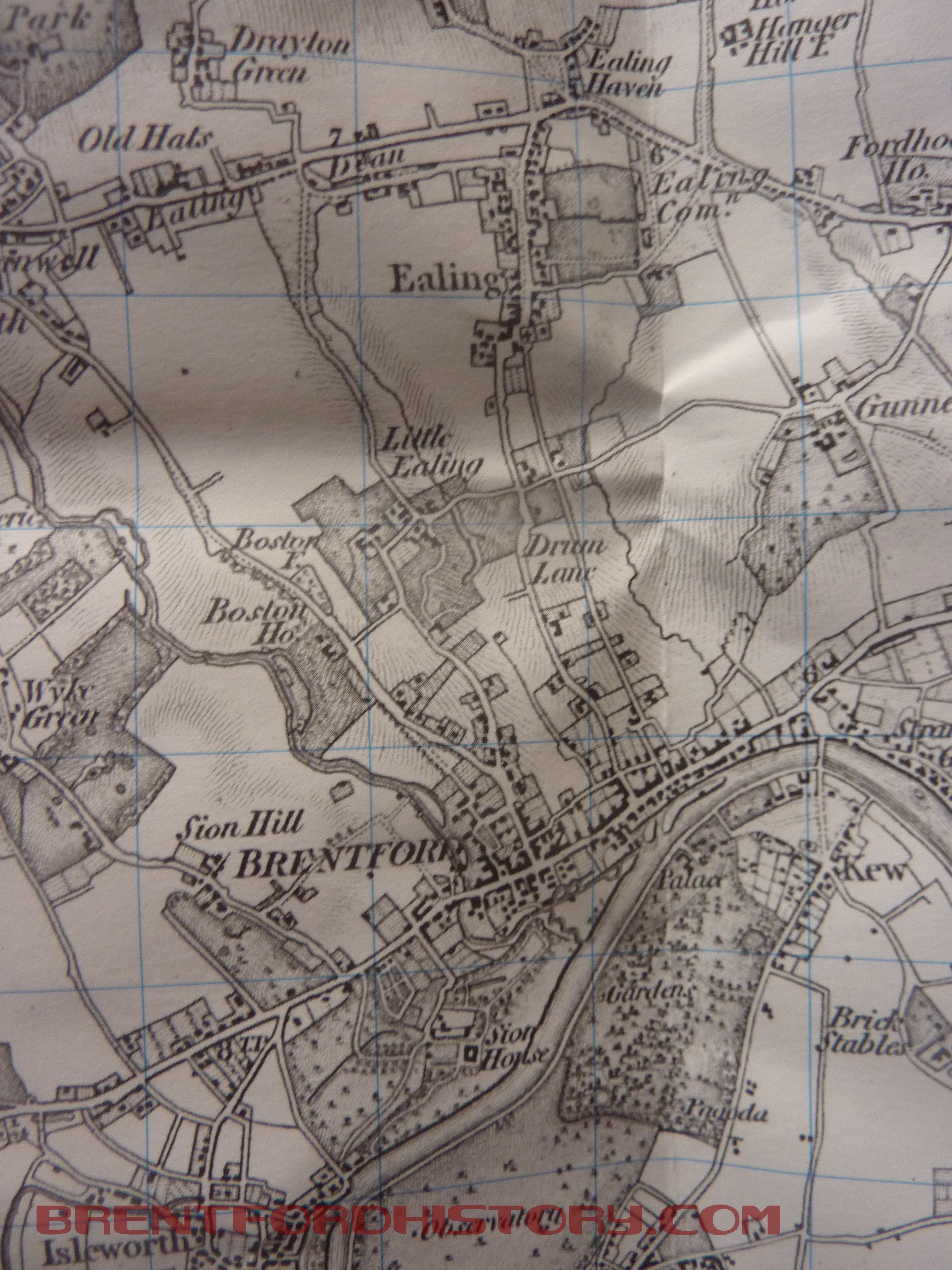
From north of Ealing this is all down hill.
Opposite Braemar Road the land drops slightly to the west so the Brook must have run behind where there are now houses, through where there’s the gap between in the houses in Lateward Road then along the edge of St Paul’s Rec, across Albany Road at the bottom of the hill, along Kings Arms alley next to Berkley House, along Town Meadow, under Ferry Quays and into the Brent (now part of the Grand Union Canal).

Very interesting indeed I lived in Brentford from 1944 until 1961 I just keep trying to remember people that lived there – any ideas and any maps around that time would be helpful.
The Local Studies Department at Chiswick Library, Dukes Ave, Chiswick have a big collection of maps and pictures of old Brentford if you want a nostalgia trip and have particular roads or periods you are particularly interested.
They are at localstudies-hct@laing.com but a visit would probably be the best.
Brentford and Chiswick Local History Society sell local history books -see http://www.brentfordandchiswicklhs.org.uk and http://www.bhsproject.co.uk is a website about local people and families in the town.
Trying to find where 4 Victoria wharf was located in Brentford, Nan came off the Narrowboats around the 1930’s and settled in this street, she did say the house backed onto the thames.